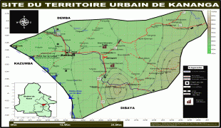
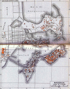
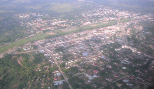
Kananga
Kananga, formerly known as Luluabourg or Luluaburg, is the capital city of the Kasai-Central Province in the Democratic Republic of the Congo and was the capital of the former Kasaï-Occidental Province. It is the fourth most populous urban area in the country, with an estimated population of 1,524,000 in 2021.
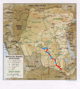
The city lies near the Lulua River, a tributary of the Kasai River and the Ilebo-Lubumbashi railway. An important commercial and administrative centre, it is home to a museum and to Kananga Airport.
German explorer Hermann Wissmann established a station in the area around present-day Kananga, on the left bank of the Lulua. Wissmann named the station Malandji, a name suggested by his 400 carriers, who were from the city of Malanje in Angola. Later on, with the construction of the railway on the other bank of the river, the station was moved, and the Lulua train station gave its name to the new town, namely Luluabourg. The old location is named Malandji-Makulu (old Malandji) to this day.
At the Belgo-Congolese Round Table Conference, in 1960, the name given to the negotiations for the independence of the then-Belgian Congo, a decision was taken that the new state would move the location of its capital from Kinshasa to Luluabourg, due to the latter's central location. However, due to multiple political setbacks, and particularly the secession attempt by Albert Kalonji and his South Kasai, this decision was never implemented. When the central government reconquered South Kasai in 1962, Luluabourg became the capital of the new Kasai-Occidental province. Kananga (as Luluabourg) was the site of the drafting of the first Congolese-written constitution for the Democratic Republic of the Congo, in 1964.
In 1966, during an Africanization campaign, Mobutu Sese Seko renamed a number of cities and towns that bore European names. Leopoldville became Kinshasa, and Luluabourg became Kananga. The name Kananga derives from the Tshiluba word kanangayi meaning "a place for peace or love" as what is now central Kananga was a gathering place for pre-colonial chiefs to discuss treaties and to settle disputes.
Under the 2006 constitution, the Democratic republic of the Congo was divided in 25 provinces, and one national Capital city (Kinshasa). The Kasai-Occidental was divided into two provinces. Kananga became the capital of the Lulua Province.
Locally, Kananga is known as Kananga-Malandji, or even Kananga-Malandji wa Nshinga. Nshinga, or cables, stands for the large high-voltage cables of the Inga-Shaba project, that cross the skies of Kananga, and that link Kolwezi and the Lualaba Province to the Inga Dam in Bas-Congo.
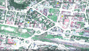
Map - Kananga
Map


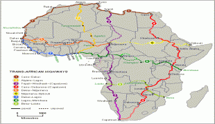


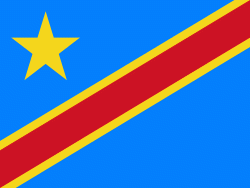
Country - Democratic_Republic_of_the_Congo
 |
 |
| Flag of the Democratic Republic of the Congo | |
Centered on the Congo Basin, the territory of the DRC was first inhabited by Central African foragers around 90,000 years ago and was reached by the Bantu expansion about 3,000 years ago. In the west, the Kingdom of Kongo ruled around the mouth of the Congo River from the 14th to 19th centuries. In the northeast, center and east, the kingdoms of Azande, Luba, and Lunda ruled from the 16th and 17th centuries to the 19th century. King Leopold II of Belgium formally acquired rights to the Congo territory in 1885 and declared the land his private property, naming it the Congo Free State. From 1885 to 1908, his colonial military forced the local population to produce rubber and committed widespread atrocities. In 1908, Leopold ceded the territory, which thus became a Belgian colony.
Currency / Language
| ISO | Currency | Symbol | Significant figures |
|---|---|---|---|
| CDF | Congolese franc | Fr | 2 |
| ISO | Language |
|---|---|
| FR | French language |
| KG | Kongo language |
| LN | Lingala language |